 | Asheville business & community directory |
|
This is an archived page that may contain outdated or incorrect information. Please visit www.Asheville.com for the latest news, events, and more.
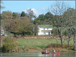
 Have you ever wondered where to put your boat in the French Broad River, or where you might find the best fishing holes? Do you want to know where to camp along the river, or stop to see an historic site? Perhaps you want to know where the whitewater is located and how to go through it or around it? A new publication, with the generous assistance of Asheville�s RiverLink, might just be the place to look for the answers.
RiverLink has been working with the Knox County (TN) Parks and Recreation Department and the Nation Park Service to create a River Access Guide for the French Broad River from Madison County, North Carolina, to Knoxville, Tennessee, for the past six years. The guide is finally finished, and it is full of information about the French Broad River. RiverLink completed a similar guide for the North Carolina section of the French Broad River in 1995, which can be viewed at www.riverlink.org. These guides are designed to help people, families, commercial outfitters, and all level of ability paddlers better utilize the river from its headwaters in Rosman, NC, to where it joins the Holston River at Volunteer Landing in Knoxville, TN.
RiverLink is a regional watershed based organization spearheading the economic and environmental revitalization of the French Broad River as a destination to work live and play. RiverLink owns the Riverkeeper� license for the entire French Broad watershed and employees a full-time River Keeper. RiverLink also designs and builds parks and greenways, does watershed planning, installs BMP�s (Best Management Practices), creates master plans for redevelopment, as well as promotes adaptive reuse of historic properties within the watershed. During the past year, RiverLink created an interactive web-based map containing 88 data layers of information about the entire French Broad River watershed. For more information, please visit their web site at www.riverlink.org. (Photos courtesy of River Link & Knox County.)
|

 These guides also were designed to promote more and better recreational and commercial usage of the entire French Broad River. To view the new maps of the Tennessee portion of the French Broad, please visit